Arizona
| State of Arizona | |||||||||||
| |||||||||||
| Official language(s) | English | ||||||||||
| Spoken language(s) | English 72.90%[1] Spanish 20.80% Navajo 1.48% | ||||||||||
| Capital | Phoenix, Arizona | ||||||||||
| Largest city | capital | ||||||||||
| Largest metro area | Phoenix Metropolitan Area | ||||||||||
| Area | Ranked 6th | ||||||||||
| - Total | 113,998 sq mi (295,254 km²) | ||||||||||
| - Width | 310 miles (500 km) | ||||||||||
| - Length | 400 miles (645 km) | ||||||||||
| - % water | 0.32 | ||||||||||
| - Latitude | 31° 20′ North to 37° North | ||||||||||
| - Longitude | 109° 03′ West to 114° 49′ West | ||||||||||
| Population | Ranked 14th in the U.S. | ||||||||||
| - Total | 7,278,717 | ||||||||||
| - Density | 57/sq mi (22/km2) Ranked 33rd in the U.S. | ||||||||||
| Elevation | |||||||||||
| - Highest point | Humphreys Peak[2][3] 12,633 ft (3852 m) | ||||||||||
| - Mean | 4,100 ft (1250 m) | ||||||||||
| - Lowest point | Colorado River at the Sonora border[2] 70 ft (22 m) | ||||||||||
| Admission to Union | February 14, 1912 (48th) | ||||||||||
| Governor | Doug Ducey (R) | ||||||||||
| Lieutenant Governor | Katie Hobbs (D) | ||||||||||
| U.S. Senators | Kyrsten Sinema (D) Mark Kelly (D) | ||||||||||
| Time zones | |||||||||||
| - Most of state | Mountain: UTC-7 | ||||||||||
| - Navajo Nation | Mountain: UTC-7/-6 | ||||||||||
| Abbreviations | AZ Ariz. US-AZ | ||||||||||
| Web site | www.az.gov | ||||||||||
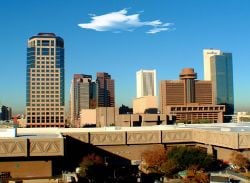
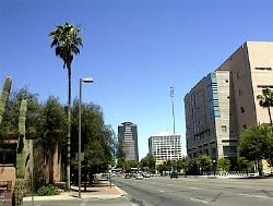
The State of Arizona is a state located in the southwestern region of the United States. The capital and largest city is Phoenix. Arizona is noted for its desert climate, exceptionally hot summers and mild winters. In contrast, the northern high country features pine forests and mountain ranges.
Arizona is a crossroad of culture and heritage intertwining many different traditions. The southern and central parts of the state are predominantly populated with Mexican-Americans. The north-central and northwestern counties are largely inhabited by residents of English ancestry. The northeastern part of Arizona has many Native Americans. The state is a recognized center of Native American art, with a number of galleries such as the Heard Museum showcasing historical and contemporary works. Sedona, Jerome, and Tubac are known as budding artist colonies, and small arts scenes exist in the larger cities and near the state universities.
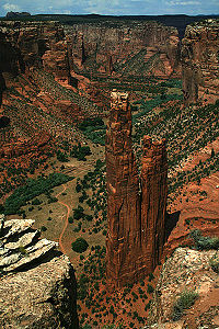
Arizona is home to such spectacular landforms as the Painted Desert and the Grand Canyon as well as many other National Forests, Parks, Monuments, and Native American reservations. The striking landscape forms a breathtaking backdrop for everything from spiritual pursuits to hiking and mountain biking trails, as well as Hollywood movie production.
Geography
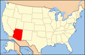
Arizona is located in the Western United States as one of the Four Corners states. It borders New Mexico, Utah, Nevada, California, touches Colorado, and has a 389-mile (626-km) international border with the states of Sonora and Baja California in Mexico. Arizona is the sixth largest state in area, after New Mexico and before Nevada. Of the state's 118,000 square miles (306,000 km²), approximately 15 percent is privately owned. The remaining area is government forest and park land, recreation areas, and Native American reservations.
Arizona is best known for its desert landscape, which is rich in xerophyte plants such as cactus. It is also known for its climate, which presents exceptionally hot summers and mild winters. Less well known is the pine-covered high country of the Colorado Plateau in the north-central portion of the state, which contrasts with the southern portions of the state.
Like other states of the Southwest, Arizona has an abundance of topographical characteristics. More than half of the state features mountains and plateaus and contains the largest stand of Ponderosa pine in the United States. The Mogollon Rim, a 2,000-foot (600 m) escarpment, cuts across the central section of the state and marks the southwestern edge of the Colorado Plateau, where the state experienced its worst forest fire in 2002. Arizona belongs firmly within the Basin and Range region of North America. This region was shaped by prehistoric volcanic eruptions, followed by a cooling off and related subsidence. The entire region is slowly sinking.
The Grand Canyon is a colorful, steep-sided gorge in northern Arizona. The canyon is largely contained in the Grand Canyon National Park—one of the first national parks in the United States. The canyon was created by the Colorado River cutting a channel over millions of years. It is about 277 miles (446 km) long, ranges in width from 4 to 18 miles (6 to 29 kilometers) and attains a depth of more than 1 mile (1.6 km). Nearly two billion years of Earth's history have been exposed as the Colorado River and its tributaries cut through layer after layer of sediment and the Colorado Plateaus was uplifted.
Arizona is home to one of the largest and most well-preserved meteorite impact sites in the world. The Barringer Meteorite Crater is a gigantic hole in the middle of the high plains of the Colorado Plateau, about 25 miles (40 km) west of Winslow. A rim of smashed and jumbled boulders, some of them the size of small houses, rises 150 feet (46 m) above the level of the surrounding plain. The crater itself is nearly a mile wide, and 570 feet (174 m) deep.
Climate
Due to its large area and variations in elevation, the state has a wide variety of localized climate conditions. In the lower elevations, the climate is primarily desert, with mild winters and hot summers. The summer months of May through August bring a dry heat ranging from 90–120°F (32–48°C), with occasional high temperatures exceeding 125°F (52°C). Due to the primarily dry climate, large temperature swings often occur between day and night, with some as large as 50°F (28°C) in the summer months.
The northern third of Arizona is a plateau at significantly higher altitudes and has an appreciably cooler climate, with cold winters and mild summers. Extreme cold temperatures are not unknown; cold air systems from the northern states and Canada occasionally push into the state, bringing temperatures below 0°F (–18°C) to the higher parts of the state.
Arizona has an average annual rainfall of 12.7 inches (322 mm), which comes during two rainy seasons, with cold fronts coming from the Pacific Ocean during the winter and a monsoon in the summer.[4] The monsoon season occurs from the middle of July through August and brings lightning, thunderstorms, wind, and torrential, if usually brief, downpours. It is rare for tornadoes and hurricanes to occur in Arizona, but there are records of both occurring.
Flora and fauna
Arizona is famous for its cacti and Ponderosa pines. Saguaro National Park and Organ Pipe Cactus National Monument preserve these. Other plants that grow in the desert are mesquite, ironwood, and paloverde trees. Forests cover one-fifth of the state, and Arizona has more Ponderosa pines than any other state.
Gila monsters (the only poisonous lizards in the United States) live in the Southern Desert, as do scorpions, geckos, and rattlesnakes. White-tailed and mule deer, elk, bighorn sheep, bobcats, coyotes, porcupines, black-footed ferrets, and pronghorns are among the mammals. The nearly 300 species of birds include sandhill cranes, eagles, hummingbirds, and quail.
History
Disagreement exists over the etymology of the name "Arizona." The two most likely explanations are that it derives from a Basque phrase aritz onak, "good oaks," or that it comes from an O'odham phrase alĭ ṣonak, "small spring".[5] The name Arizonac was initially applied to the silver mining camp and later (shortened to Arizona) to the entire territory.
Prehistory
Paleo-Indians arrived in Arizona about 12,000 years ago but eventually disappeared. The Anasazi settled in the northwestern section of the state about 2000 years ago and built homes among the cliffs. The Hohokam arrived from Mexico around 300 C.E. Both groups had moved on due to a prolonged drought at the time of European contact.
Marcos de Niza, a Spanish Franciscan, explored the area in 1539. The expedition of Spanish explorer Coronado entered the area in 1540–1542 during its search for Cíbola. Father Kino developed a chain of missions and taught the Indians Christianity in Pimería Alta (now southern Arizona and northern Sonora) in the 1690s and early 1700s. Spain founded fortified towns (presidios) at Tubac in 1752 and Tucson in 1775.
Won from Mexico
When Mexico achieved its independence from Spain in 1821, what is now Arizona became part of the Mexican state Nueva California, also known as Alta California.[6] In the Mexican–American War (1847), the United States occupied Mexico City and forced the newly founded Mexican Republic to give up its northern territories, including Arizona. The Treaty of Guadalupe Hidalgo (1848) specified that the United States pay Mexico $15 million in compensation. In 1853 the land below the Gila River was acquired from Mexico in the Gadsden Purchase. Arizona was administered as part of the Territory of New Mexico until southern New Mexico seceded[7] from the Union as the Confederate Territory of Arizona on March 16, 1861. Arizona was recognized as a Confederate Territory by presidential proclamation by Jefferson Davis on February 12, 1862. This was the first official use of the name. A new Arizona Territory, consisting of the western half of New Mexico Territory, was declared in Washington, D.C., on February 24, 1863. The new boundaries would later form the basis of the state. Arizona became a U.S. state on February 14, 1912, becoming the last of the contiguous states to join the Union.
Statehood
Cotton farming and copper mining, two of Arizona's most important statewide industries, suffered heavily during the Great Depression, but during the 1920s and 1930s tourism began to develop into the important Arizona industry it is today. Dude ranches gave tourists the chance to experience the flavor and life of the "old West."
Arizona was the site of German and Italian POW camps and Japanese-American internment camps during World War II.
Arizona's population grew tremendously after World War II, in part because of the development of air conditioning, which made the intense summer heat more comfortable. The state's population in 1910 was 294,353. By 1970, it was 1,752,122. The percentage growth each decade averaged about 20 percent in the earlier decades and about 60 percent each decade thereafter.
The 1960s saw the establishment of retirement communities, special age-restricted subdivisions catering exclusively to the needs of senior citizens who want to escape the harsh winters of the Midwest and the Northeast. Sun City was one of the first such communities. (Many of these senior citizens stay only during the winter months and are referred to as snowbirds.)
Economy
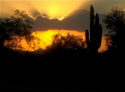
Early in its history, Arizona's economy relied on what was termed the "Five C's": copper, cotton, cattle, citrus, and climate (tourism). At one point Arizona was the largest producer of cotton in the country. Copper is still extensively mined from many expansive open-pit and underground mines, accounting for two-thirds of the nation's output. The state government is Arizona's largest employer, while Wal-Mart is the state's largest private employer.
Government and politics
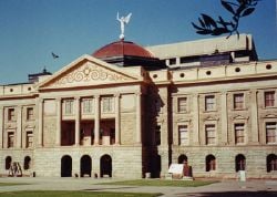
State legislature
The Arizona legislature is bicameral and consists of a 30-member Senate and a 60-member House of Representatives. Each of the thirty legislative districts has one senator and two representatives. Legislators are elected for two-year terms. Each legislature covers a two-year period.
Arizona state senators and representatives are elected for two-year terms and are limited to four consecutive terms in a chamber, though there is no limit on the total number of terms. When a lawmaker is term-limited from office, it is not uncommon for him or her to run for election in the other chamber.
Arizona's executive branch is headed by a governor elected for a four-year term. The governor may serve any number of terms, though no more than two in a row.
Politics
Traditionally, the state is politically known for national conservative figures such as Barry Goldwater and John McCain.
Arizona politics are dominated by a longstanding rivalry between its two largest counties, Maricopa and Pima—home to Phoenix and Tucson, respectively. The two counties have almost 75 percent of the state's population and cast almost 80 percent of the state's vote. They also elect a substantial majority of the state legislature.
Maricopa County, the fourth-largest county in the country and home of Phoenix, is home to almost 60 percent of the state's population, and most of the state's elected officials live there.
In contrast, Pima County, which includes Tucson, and most of southern Arizona has historically been more Democratic. While Tucson's suburbs lean Republican, they tend to be more moderate than Republicans in the Phoenix area.
Demographics
Important cities and towns
Phoenix, the largest city in the state, is the capital. Tucson is the state's second largest city, located 110 miles (180 km) southeast of the Phoenix metropolitan area. The Tucson metropolitan area crossed the one-million-resident threshold in early 2007. It is home to the University of Arizona.
Yuma, center of the third largest metropolitan area in Arizona, is located near the borders of California and Mexico. It is one of the hottest cities in the United States with the average July high of 107 degrees Fahrenheit. The city also features sunny days about 90 percent of the year and attracts many winter visitors from all over the United States.
Flagstaff is the largest city in northern Arizona, and at nearly 7000 ft elevation, is a stark contrast to the desert regions typically associated with Arizona. Flagstaff is the home of the main campus of Northern Arizona University.
Ethnicity
Arizona has one of the highest numbers of Native Americans of any state in the Union. Only California and Oklahoma have more Native Americans. The perimeters of Phoenix, Tucson, Prescott, and Yuma abut Indian reservations.
The largest ancestry groups in Arizona are Mexican, German, English, Irish, and Native American. The southern and central parts of the state are heavily Mexican-American, especially in Santa Cruz County and Yuma County near the Mexican border. The north-central and northwestern counties are largely inhabited by residents of English ancestry. The northeastern part of Arizona has many American Indians. African Americans have had a relatively small presence in Arizona, but their numbers are increasing due to in-migration from other states, especially California, the Midwest and the Northeast. The African American population of the Phoenix metropolitan area doubled between 1990 and 2005.
Language
The majority of Arizona residents speak only English at home. Spanish is the second most commonly spoken language, with Navajo the third most spoken language.[1]
Religion
The three largest denominational groups in Arizona are the Catholic Church, the Church of Jesus Christ of Latter-Day Saints and non-denominational Evangelical Protestants, with small numbers of Christians of other denominations. There are also small numbers of Jews, Hindus, Muslims, and Buddhists, as well as others who are non-affiliated.
Education
Elementary and secondary
Public schools in Arizona are separated into about 220 local school districts, which operate independently but are governed in most cases by elected county school superintendents. In 2005, a School District Redistricting Commission was established with the goal of combining and consolidating many of these districts.
Colleges and universities
Higher education in Arizona is governed at the university level by the Arizona Board of Regents or the ABOR, a 12-member body. Public schools are Arizona State University, Northern Arizona University, and University of Arizona. The community college systems in Arizona are among the best in the United States.
Notes
- ↑ 1.0 1.1 Most spoken languages in Arizona in 2010 MLA Language Map Data Center. Retrieved March 7, 2021.
- ↑ 2.0 2.1 Highest and Lowest Elevations USGS. Retrieved March 7, 2021.
- ↑ The San Francisco Volcanic Field, Arizona USGS. Retrieved March 7, 2021.
- ↑ Hydrologic Conditions in Arizona During 1999–2004: A Historical Perspective U.S. Geological Survey. Retrieved March 7, 2021.
- ↑ William Bright, Native American Place Names of the United States (Norman: University of Oklahoma Press, 2004), 47.
- ↑ Timothy Anna et al., Historia de México (Barcelona: Critica, 2001), 10.
- ↑ Arizona Ordinance of Secession Sons of Confederate Veterans. Retrieved March 7, 2021.
ReferencesISBN links support NWE through referral fees
- Anna, Timothy, et al., Historia de México. Barcelona: Critica, 2001.
- Bayless, Betsy, Secretary of State. 1998. Arizona Blue Book, 1997-1998. Phoenix, State of Arizona.
- Bright, William. Native American Place Names of the United States. Norman: University of Oklahoma Press, 2004.
- Filbin, Dan. 2002. Arizona. Minneapolis, MN: Lerner Publications. ISBN 0822540630
- Standard, Carole K. 2002. Arizona. New York: Children's Press. ISBN 0516223151
- Thomas, David M. Ed. 2003. Arizona Legislative Manual - Retrieved December 12, 2007.
- Trimble, Marshall. 1998. Arizona, A Cavalcade of History. Tucson, Treasure Chest Publications. ISBN 0918080436
External links
All links retrieved August 15, 2023.
- Official Website of the State of Arizona
- Arizona Game & Fish Department (Hunting, Boating & Fishing)
- Arizona State Parks
| Political divisions of the United States | |||||||
|---|---|---|---|---|---|---|---|
| |||||||
Credits
New World Encyclopedia writers and editors rewrote and completed the Wikipedia article in accordance with New World Encyclopedia standards. This article abides by terms of the Creative Commons CC-by-sa 3.0 License (CC-by-sa), which may be used and disseminated with proper attribution. Credit is due under the terms of this license that can reference both the New World Encyclopedia contributors and the selfless volunteer contributors of the Wikimedia Foundation. To cite this article click here for a list of acceptable citing formats.The history of earlier contributions by wikipedians is accessible to researchers here:
The history of this article since it was imported to New World Encyclopedia:
Note: Some restrictions may apply to use of individual images which are separately licensed.

